News

23 • 11 • 2020
LVM GEO Offers New Features
New features are available to users of the LVM GEO map browser (https://lvmgeo.lvm.lv/), which allows nature walkers to plan their recreation in nature, for example, go hiking or cycling, as well as mark and save a stop of interest on their smart device.
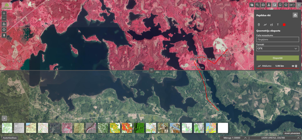
The new functionality of the application allows you to mark certain points, as well as draw lines and squares, measure distances and export this information to GPX, KMZ and KML format files, which can be opened in LVM GEO mobile application, as well as in other smart device applications.
“The new version of LVM GEO browser maps has a number of long-awaited functionalities both for ourselves and our users, which greatly expands the options for working with maps, analysing them, using them for professional needs, as well as for planning your holiday adventures. This functionality was created by our LVM GEO development team within our internal hackathon to provide new opportunities specifically for the users of our publicly available map applications,” tells Katrīna Amerika, LVM Geospatial Solution Project Manager.
New features in the upgraded LVM GEO application
The upgraded LVM GEO application provides new options that will be appreciated not only by active hikers, but also by professionals in various fields. In addition to the option to share map view parameters, users can also use a variety of coordinate systems that allows them to search, convert, and share locations. Nature enthusiasts will appreciate the opportunity to hide tools and view a larger map, as well as view photos of LVM tourist facilities and sites or prepare a preview of a map printable area while still at the computer. The app also provides tools for comparing and merging maps, which allows users to make background maps transparent or put two maps side by side and compare them by dragging the separator line.